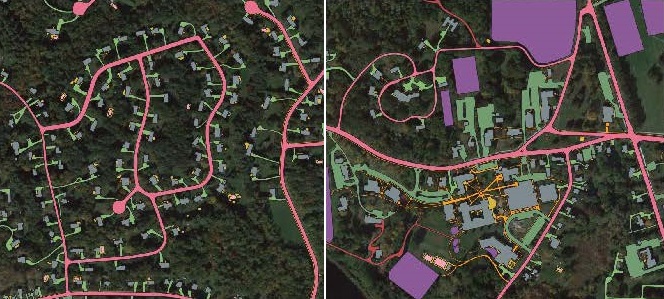
Above: Conservation is hosting a webinar about the mapping data for impervious surfaces in Southborough. (images from flyer)
The Town issued a public invitation to a webinar tonight on Impervious Surfaces:
Join us tonight for a presentation on the final deliverable under our MVP Action Grant for the creation of an Impervious Surfaces Data Layer. We will cover what the MVP Program is, overview of impervious surfaces, results from the data layer, and where we go next!
MVP refers to the Town’s Municipal Vulnerability Preparedness for serious storms, natural disasters, and climate change impacts.
As I previously posted, Southborough’s Conservation Agent Melissa Danza held a webinar last week about Impervious Surfaces. That one described what they are and how to mitigate some of the negative impacts.
Based on the language in the announcement, I asked Danza if this session relates to our Town’s GIS Map. (Last year, the Town issued an RFQ for a contractor to map our impervious surfaces.)
Danza responded:
This is a new GIS layer that has not been uploaded to the Town’s GIS system but will in the future. Right now it is an internal data layer that we are using for information and research for the impacts of impervious surfaces especially near wetland resource areas. The layer was created using updated aerial imaging that the vendor, Sanborn (a mapping company) does in a high resolution format much as MassGIS does so it is a similar system. In the future the goal is to be able to have it on the Town’s website for public viewing and be able to toggle the layer on and off as you would do now for things such as zoning layers, wetlands, etc.
The presentation is over zoom at 5:30 pm tonight (Wednesday, June 222nd). Click here for details about connecting to the zoom session.
The webinar will be recorded for future viewing. You should eventually expect to be able to find that here (usually in less than a day from when it was streamed live).


